About the Project
This update details the status of the CP 55 project, taking place north of Kaslo along Hwy 31.
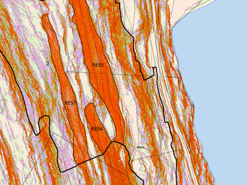
This project was initiated due two forest fires starting near Schroeder Creek in the past 15 years by trees falling on the power lines, which luckily didn’t spread too far thanks to the efforts of the KVFD and BCWS. The project includes 14ha of manual treatment above Lardeau, and 20ha of mechanical stretching from just north of the Lost Ledge campground to Lardeau.
The forest cover in the project area consisted of a mix of mature timber and immature trees. This is a result of previous land clearing from power lines and mining, as well as root rot centres.
Wildfire Risk Reduction
Wildfire risk reduction work has many different approaches, with the existing stand and desired outcome driving the planned treatment. The treatments can range from manual thinning from below (removing ground and ladder fuels with chainsaws), to using a feller buncher to provide crown separation (removing a small amount of trees) or to clear larger areas.
The mechanical portion of this project aimed to reduce the risk of wildfire by removing trees that could strike the power lines. This would be done by reducing fuel loads — and removing approximately 50% of the volume through a mix of reserves, patch cuts and single tree retention. We would also install access above the power lines utilizing old trails in the area. After completing an area along Hwy 31, which required removing all trees that can fall within 10ft of the power line, the results are noticeable from the highway.
Through feedback from the community we altered our plans for areas near the highway and power line. We’ll be adding more reserves so the project won’t be as visible from the community. While this doesn’t meet one of our objectives of removing trees along the power line, the overall goal of the project will still be realized due to the fuel breaks and access, and the visual effect from Hwy 31 will be limited. A field tour will be held post treatment — keep an eye on our website and social media for more information on when this information becomes available.
Questions
Questions and comments can be directed to the board at manager@kaslocommunityforest.org. Maps of the project can be found below or by emailing the address above.
 November 2025 General Board Meeting Update