• Menu
  • Skip to primary navigation
  • Skip to secondary navigation
  • Skip to main content

Kaslo & District Community Forest Society

  • Home
  • Latest News
    • View All Latest News
    • Wildfire Planning News
    • Society News
  • About the KDCFS
  • Wildfire Planning
  • Forest License
    • Overview
    • Kaslo / Bjerkness-Fletcher
    • Cooper-Davis
    • Shutty Bench
    • Keen Creek
  • Community Values
    • Water
    • Recreation
    • Contributions
  • Resources
  • Member Area
  • Contact
  • Home
  • Latest News
  • About the KDCFS
  • Wildfire Planning
  • Forest License
  • Community Values
  • Resources
  • Member Area
  • Contact
  • Home
  • Latest News
    • View All Latest News
    • Wildfire Planning News
    • Society News
  • About the KDCFS
  • Wildfire Planning
  • Forest License
    • Overview
    • Kaslo / Bjerkness-Fletcher
    • Cooper-Davis
    • Shutty Bench
    • Keen Creek
  • Community Values
    • Water
    • Recreation
    • Contributions
  • Resources
  • Member Area
  • Contact
Kaslo & District Community Forest Society

Sabrina Mutterer

Fall Operations resume: September 2021

September 2, 2021

Fall harvest operations have now resumed in 2 of our CFA locations: Keen Creek CP51 and Cooper Face CP48.

Keen Creek CP51

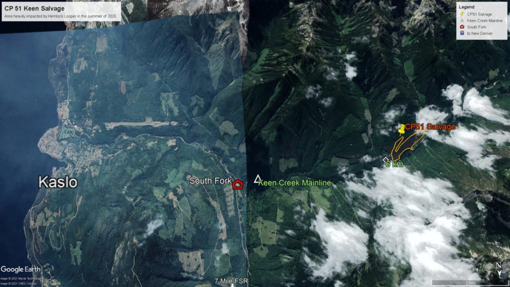
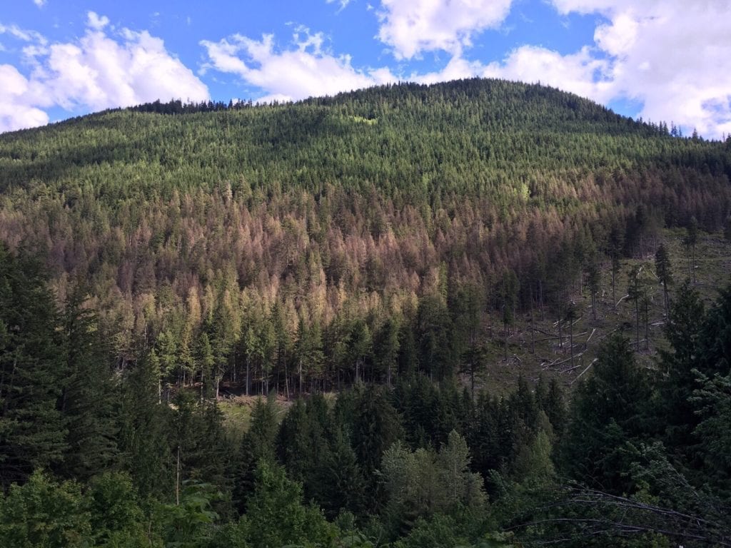
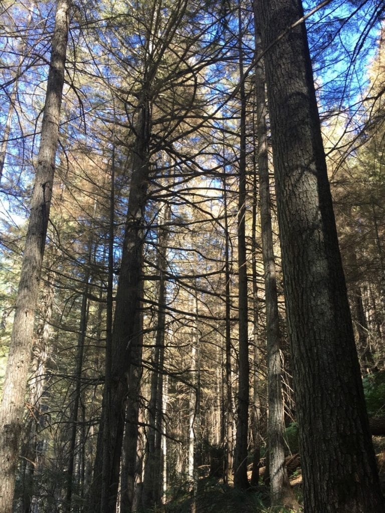
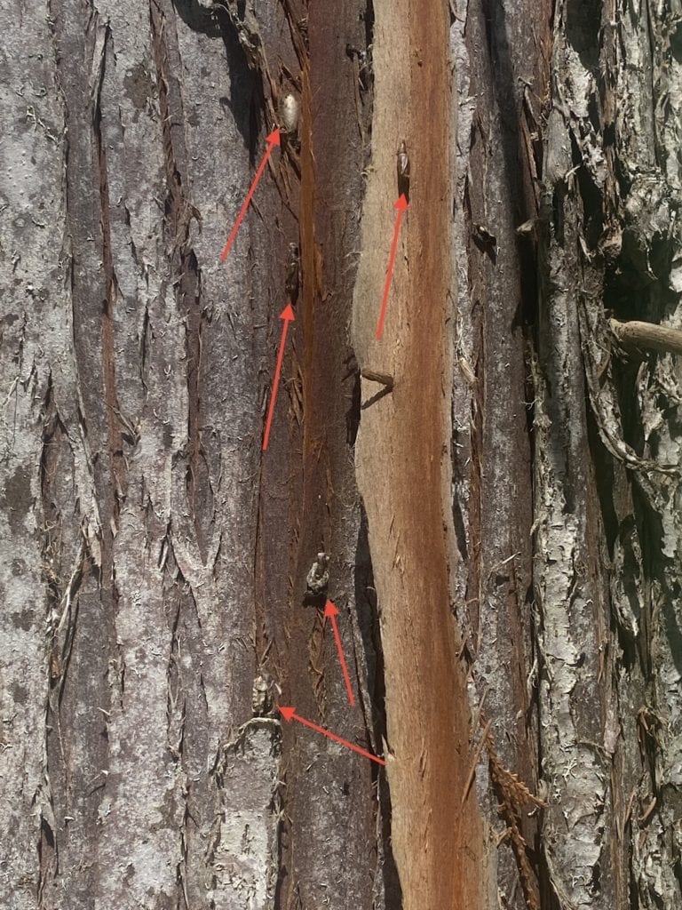
Timber Ridge Contracting Ltd (Shane McKinnon) has relocated from Lost Ledge to Keen Creek at the end of August. He will be harvesting the conventional portion of this salvage block. A cable logger will complete the steeper sections in the permit. We were happy to see that in some areas the 2020 looper damaged trees recovered, which was unfortunately not the case here. Wood will feed the Kalesnikoff, Porcupine, and mostly Mercer mill, with a high pulp component. We want to finish the salvage prior to winter weather so we can properly winterize the Keen Creek mainline.

Cooper Face CP48

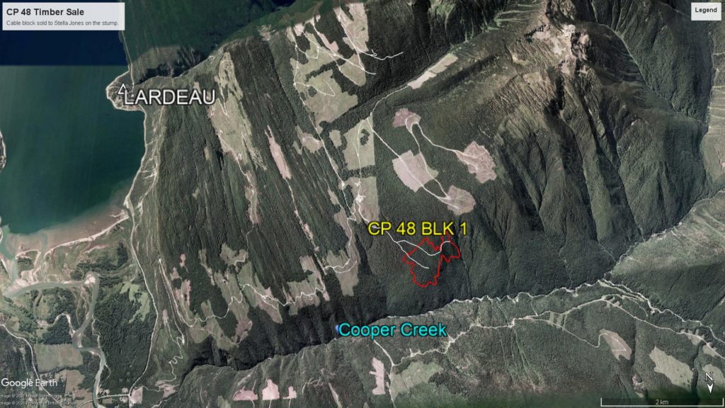
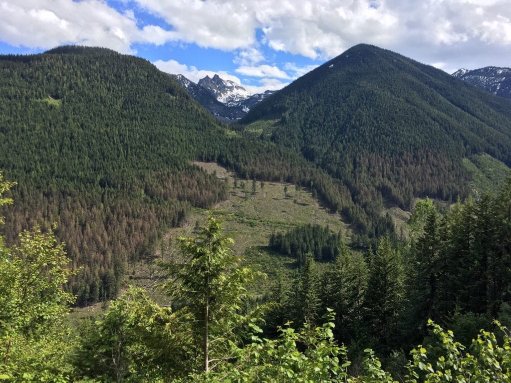
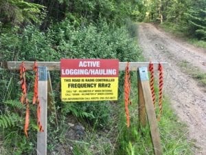
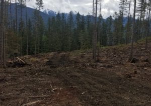
It has taken us some time to find a cable logger for this steep block, but Stella Jones has now signed a contract and started up their Silverton based logger “Iron Peak Logging Inc. ” in the first week of September. This block will yield ca 18,0000m3 of mixed species timber, and will not be completed prior to the winter, since we lost harvest time in this summer’s wildfire season.

Also on the Fall Schedule will be:

  • Nashton CP44 Block 1, a small block on the hillside behind the Kaslo Transfer station. The road access was built earlier this summer.
  • Shutty Bench CP42 Blk4, a small block behind the Mauboules Farm

Filed Under: Cooper Davis, Keen Creek, Latest News

UBC wildfire research in the KDCF

July 29, 2021

Dr. Lori Daniels (Tree Ring Lab) and her research team are collaborating with community forests around BC to assess the efficacy of treatments to
reduce wildfire risk and hazards.

Their research approach is to measure and compare fuels treated and untreated areas and use stand-level models to assess probability of fire and potential fire effects. Ideally, they measure data before and after treatments, as well as nearby forests that are not being treated. Our invitation to Dr. Daniel’s crews was accepted and they spent the week of July 12 to 16 establishing research plots in both, the Kaslo-Shutty corridor and the Schroeder wildfire risk reduction project.

https://treering.forestry.ubc.ca/

Kea Rutherford, (UBC Research Lead) and Sabrina Mutterer (KDCFS Manager)

Filed Under: Latest News, Wildfire Planning News

Fire weather shut down – August 2021

July 29, 2021

We now are well into fire season and conditions are still challenging. Fire Danger ratings temporarily settled down after a week of steady rain, but have already climbed back to extreme risk, and causing restrictions to high risk activities. Rain is forecast, but overall much more is needed to be finally on the safe side.

In the Wildfire Regulation, high risk activities mean each of the following: 
(As per Wildfire Regulation consolidated July 13, 2006)

(a) mechanical brushing; 
(b) disk trenching; 
(c) preparation or use of explosives; 
(d) using fire- or spark-producing tools, including cutting tools; 
(e) using or preparing fireworks or pyrotechnics; 
(f) grinding, including rail grinding; 
(g) mechanical land clearing; 
(h) clearing and maintaining rights of way, including grass mowing; 
(i) any of the following activities carried out in a cutblock excluding a road, landing, roadside work area or log sort area in the cutblock: 
    (i) operating a power saw; 
    (ii) mechanical tree felling, woody debris piling or tree processing, including de-limbing; 
    (iii) welding; 
    (iv) portable wood chipping, milling, processing or manufacturing; 
    (v) skidding logs or log forwarding unless it is improbable that the skidding or forwarding will result in the equipment contacting rock; 
    (vi) yarding logs using cable systems; 

Map showing levels of precipitation across B.C

We were spared in a week of nail-biting thunderstorms and incurred only a few strikes, which were immediately and thankfully extinguished by BCWS initial attack crews. Neighbouring Community Forests and Forest Licencees were less fortunate and our thoughts are with the communities threatened and impacted by fires. As temperatures remain above 30 degree Celsius for the foreseeable future and little rain is in sight, we are questioned every day by concerned residents when the ‘bush will finally shut down’.

Public education resulting in informed decision making are preferred solutions to regulatory enforcement.

We are including the July 27 BCWS bulletin which explains roles and responsibilities of the various agencies and provides helpful links to further information – view pdf

You can find BCWS bulletins here: http://bcfireinfo.for.gov.bc.ca/hprScripts/WildfireNews/News.asp

We thank everyone for exercising a high degree of caution in our backcountry at this precarious time. Please remain vigilant to any sign of fire on the landscape, and report to 1 800 663-5555 or *5555 on a cell.

Filed Under: Wildfire Planning News

Next Board Meeting: September 22, 2021 at 6:30pm

July 28, 2021

We invite you to join our next Board meeting on September 22, 2021 at 6:30pm.

The regular monthly meeting date is typically on the 3rd Wednesday of each month.

Link to ZOOM Virtual Meetings: https://us02web.zoom.us/j/6949720471

The Board welcomes input from the public during a five minute consultation period at the end of each meeting. Please visit one of our Board meetings to express your interest in participating in one of our following Committees:

  • Finance / Budget
  • Long Term Planning
  • Communications
  • Governance / Policy / Personnel
  • Recreation
  • New Ventures

Agenda September 22 2021

Manager’s Report August 2021 https://kaslocommunityforest.org/wp-content/uploads/2021/09/Mgmt-Report-July-August-2021.pdf

Minutes July 21 2021 https://kaslocommunityforest.org/wp-content/uploads/2021/09/2021-07-21-Minutes.pdf

Filed Under: Latest News, Society News

Hemlock Looper outbreak – Keen Creek

June 30, 2021

The western hemlock looper has historically not been a catastrophic forest insect in our Kootenay Lake landscape. The looper feeds on conifer needles and severely defoliates and in the process often kills all sizes of western hemlock and associated trees in western hemlock stands that are older than 80 years.

It also interacts with other agents, such as bark beetles, to cause tree mortality of defoliated trees. By causing topkill in all sizes of trees, L. fiscellaria lugubrosa contributes to the formation of unique limb structures and facilitates the colonization of living tree boles by stem decay. During outbreaks, high numbers of larvae pupae, and moths provide abundant forage for many species of birds and invertebrates.

The tiny eggs of this species hatch over a period of weeks beginning in June. The looper larvae feed briefly on new foliage and then retreat to older foliage. The larger larvae are very messy feeders, moving about “nipping” foliage (which later dies) and, when disturbed, dropping from the trees onto undergrowth where defoliation is often heaviest. Although much of the defoliation by mature larvae occurs on older foliage, when this is gone new foliage may be stripped as well.

The ground beneath heavily infested trees may also be covered with a mat of “nipped” or partly chewed needles. In late July, larvae begin seeking out protected spots to pupate. The variable, brown and green, spotted pupa has no cocoon and is formed in cracks and crevices on the tree bole, objects nearby or in the litter. Mature larvae “spin down” on silken threads from feeding sites to lower branches and the ground during August and early September to pupate. During this time they may be found crawling over tree trunks and understory vegetation, and loose webbing may be abundant. Pupation occurs in trunk bark crevices, lichens, mosses, or ground debris, usually lasting 10 to 14 days.

Adults generally fly in late August through early October, dying soon after mating and laying eggs.By mid-August, after a pupal period of 2-3 weeks, the frail, tan moths begin to appear and flutter about. In heavily infested stands it is not uncommon to find large numbers of moths resting on trunks of trees and on low deciduous vegetation. These fly readily when disturbed. Moths are present from mid-August to October. Mating takes place on resting sites and “coupled” pairs of moths often show different color variations. The very tiny eggs are deposited singly or in small clusters on foliage, twigs, bark, understory vegetation, debris or in the litter.

We conducted a license overview flight reconnaissance in the summer of 2020 and are relieved that some areas impacted by the looper last year recovered. We are however in the process of laying out a permit in Keen Ck which includes 50-60 ha of bug killed western hemlock forest to be salvaged between August and November this year. You can find more information in the Forestry Section soon.

Filed Under: Keen Creek, Latest News, Nature

Wildfire Planning

Campfire Prohibitions are in Effect

June 29, 2021

Effective at noon (Pacific time) on Wednesday, June 30, 2021, Campfires, Category 2 and Category 3 open fires will be prohibited throughout the province of British Columbia.

This prohibition will remain in effect until noon on Oct. 15, 2021, or until the order is rescinded.

https://news.gov.bc.ca/releases/2021FLNRO0051-001261

People can follow the latest wildfire news from the BC Wildfire Service:
The free public mobile app, available for Apple (iOS): https://apps.apple.com/us/app/bc-wildfire-service/id1477675008?ls=1
And Android: https://play.google.com/store/apps/details?id=ca.bc.gov.WildfireInformation&hl=en
Twitter: twitter.com/BCGovFireInfo
Facebook: facebook.com/BCForestFireInfo

The provincial weather forecast calls for record-breaking high temperatures throughout B.C. this week and follows a spring of lower-than-average precipitation in the southern half of the province. These conditions are expected to persist in the coming weeks.

Camping is a long-standing tradition in this province. The B.C. government recognizes that people also enjoy having campfires, so it takes any decision to implement a campfire ban very seriously.

The BC Wildfire Service takes these extreme heat conditions seriously. Additional precautions are being undertaken throughout the province, including fire warden patrols, fixed-wing aircraft patrols and an active enforcement presence. Wildfire prevention is a shared responsibility. Human-caused wildfires are completely preventable and divert critical resources away from lightning-caused fires.

The BC Wildfire Service is constantly monitoring current and forecast conditions and maintaining preparedness.

A campfire is defined as any fire smaller than 0.5 metres high by 0.5 metres wide.

In addition to campfires, Category 2, and Category 3 open fires, the following activities are also prohibited:

  • The use of fireworks
  • The use of sky lanterns
  • The use of burn barrels or burn cages of any size or description
  • The use of binary exploding targets
  • The use of tiki and similar kinds of torches
  • The use of chimineas
  • The use of outdoor stoves or other portable campfire apparatus without a Canadian Standards Association (CSA) or Underwriter Laboratories of Canada (ULC) rating
  • The use of air curtain burners in Cariboo, Coastal, Northwest, Prince George and Southeast fire centres  

To report a wildfire, unattended campfire, or open burning violation, call 1 800 663-5555 toll-free or *5555 on a cell phone.

View the information bulletin for full details here: http://ow.ly/fp9H30rLUmP

Filed Under: Latest News, Wildfire Planning News

Charity Firewood Draw 2021 and Firewood Sales

June 15, 2021

The Kaslo and District Community Forest Society is taking reservations for logging truck loads of mixed species firewood. The first-come, first-serve lists are open to individuals and businesses from within Kaslo and Area D.  Price: $2,750 including GST and trucking within this area. Email: manager@kaslocommunityforest.org, Subject: “Firewood” to join the list and include your phone number. Questions? Call (250) 353-2384 or (250) 354-9803.

Branch 7 is now open for community firewood collection.

We received seven applications for our 2021 Charity Firewood draw. The directors have struck a committee to decide this year’s winners of our three truckloads of logs. The decision will be brought to the August 18 board meeting.

Filed Under: Latest News, Society News

Milford FSR temporary Harvesting Closure

June 7, 2021

We started harvesting at approximately 2km on the Milford FSR in mid May. This road will be closed to traffic on weekdays from 5:00 AM to 5:00 PM until approximately the end of June. Please view our Forest License / Shutty Bench menu page for more information on CP42 Blocks 1, 2 and 3.

Filed Under: Shutty Bench

Hydrocarbon films or petroleum?

June 7, 2021

We recently investigated a potential petroleum spill in a small seep area at one of our skid trails.

I had traveled though this saturated area with my ATV repeatedly to action a small wildfire by the lookout below. You can see the track in the picture.

At the time there was no contamination visible in the wet soil, it however appeared a short time after.

The wet area is soft and the organic soil was churned as we passed through with heavy loads of water and gear. Hydrocarbon films can be produced naturally by bacterial action in organic matter in the absence of oxygen. I have observed this phenomenon before in areas untouched by motorized equipment.

Deceptively similar looking, petroleum films tend to swirl and reform, while natural oils don’t. They break up into little angular platelets – which is what happened when I disturbed this film. Although I tried to scoop a good load up on my fingers there was no greasiness at all to the touch. I also detected no smell, which is fairly noticeable with petroleum products.


From Clemson University (https://www.clemson.edu/extension/water/stormwater-ponds/problem-solving/muddy-turbid-water/index.html) “Hydrocarbons and oils are usually the other source of surface films in ponds. Oils are produced naturally by the decay of leaves, algae and organic matter, but these oils behave differently from cooking oil or motor oil. To determine if the oil sheen you see on your pond is from a natural organic source, poke it with a stick. If it is from the decay of leaves and other organics, it will most likely crack and shatter like a thin layer of glass and will not reform as the stick is removed. If it reforms or does not shatter, it is likely from automotive or cooking oils that have washed into the pond. “

Filed Under: Latest News, Nature

Careful with Campfires !

June 7, 2021

A word of caution: think twice before lighting a fire in the forest. We spent most of Saturday May 15 extinguishing a smoldering camp fire with the help of BC Wildfire Service and volunteers from our recreation clubs. The hot spot was reported near the Wardner viewpoint above Kaslo. This forested area is on a south-east facing, hot and steep slope which abuts directly to residences in upper Kaslo. The lower to mid elevation landscape has received very little snow during the winter and is already unseasonably dry. We fortunately have created motorized access into this area during our wildfire risk reduction work last fall and this spring. The primary objective of our landscape level wildfire planning is to improve the speed of response for water delivery. This area is in a very high risk zone, which lacks natural water sources.

Even in a deeply dug fire pit hot air vents between the larger stones, and ignites a connected web of roots, which smolder underground to other places. The rocks themselves store heat for a long time. Even on an overcast day, your fire may ignite ‘fuses’ underground. We check our winter pile burns in the spring for this reason, as they may flare up again after months of cold weather. This was the case just recently with one of our January burn spots in our Schroeder Creek project, which had to be water saturated and dug up by Stan Baker’s excavator. Please don’t take any chances this year, the drought indices are off the charts already. Plan your fires where you have ample water and tools to extinguish them properly.

Filed Under: Wildfire Planning News

  • Page 1
  • Page 2
  • Go to Next Page »
  • Home
  • Latest News
  • About the KDCFS
  • Wildfire Planning
  • Forest License
  • Community Values
  • Resources
  • Member Area
  • Contact

Copyright © 2025 · Kaslo & District Community Forest Society - All Rights Reserved · Website by Battery Studios