Keen Creek
The Keen Creek (S2) drainage encompasses roughly 30 percent of our license area. It abuts to Kokanee Glacier Provincial Park along the southern boundary. A small neighbourhood is established at South Fork, at the junction of Hwy 31A and the Keen Creek valley entrance.
The rugged, steep and narrow valley runs roughly northeast – southwest – thus sun warming of the narrow valley floor occurs only for a short time each day during summer and barely during winter. Ecosystems within are populated with plants and trees that gravitate to the colder environment, such as Western Hemlock, Western Cedar, Engelmann Spruce and Subalpine Fir. Spring snow retention lasts into summer and deeply incised streams carry water year-round into Keen Creek, which is fed by Kokanee Glacier. The rough and narrow main access into the valley follows the valley bottom. The majority of this unit requires cable harvesting systems. Keen Creek is rich in old mining features.
Additional Interactive Maps:
*Links open in a new window/tab.
Resources:
| Title | File Type | Date | Categories | Link |
|---|---|---|---|---|
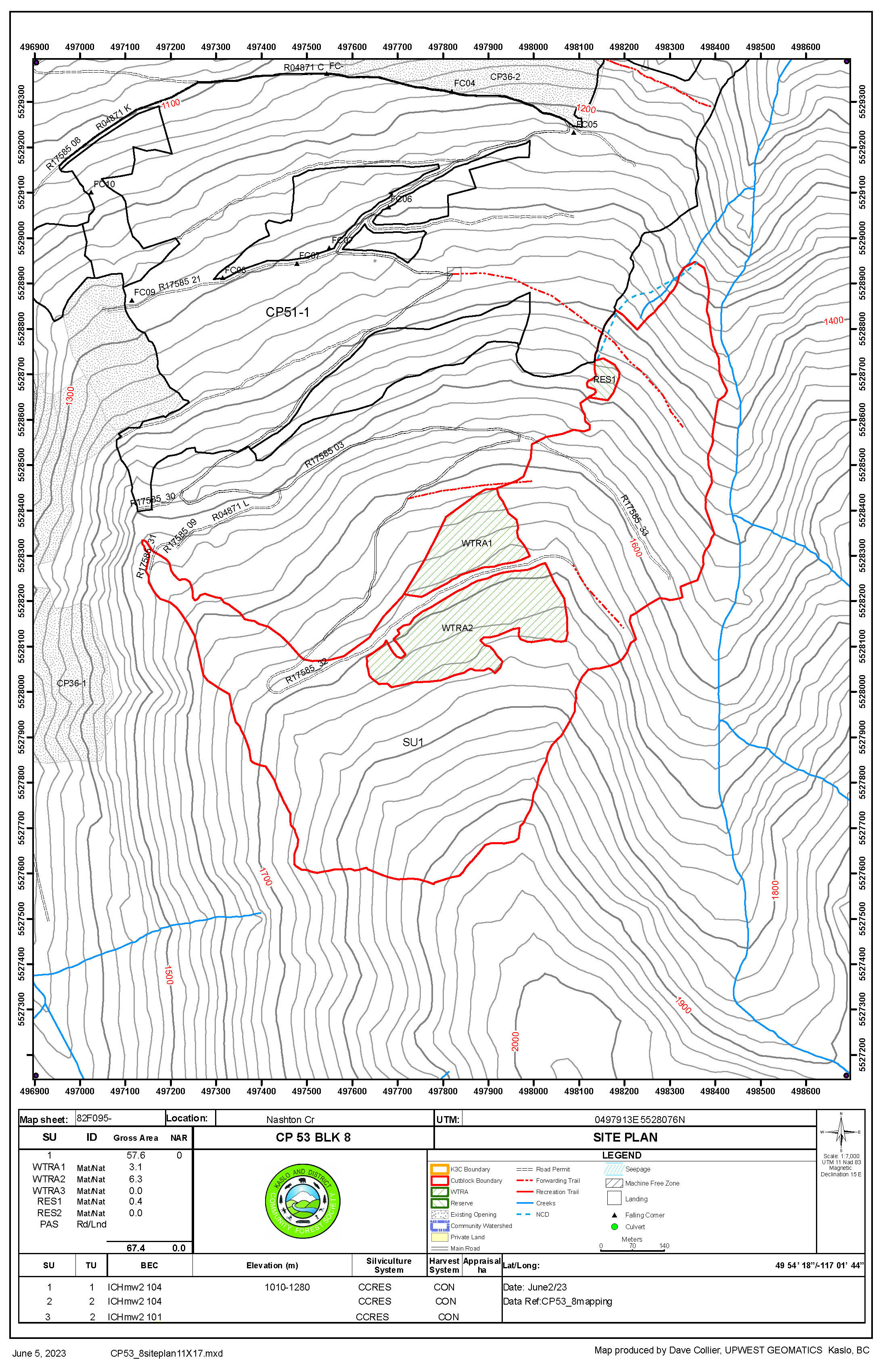
CP 51 Blk 2 Site Plan Map | September 2, 2021 | Keen Creek | ||
CP 44 Blocks Overview | May 12, 2021 | Keen Creek | ||
FSP Map K3C Keen Creek | June 6, 2019 | Keen Creek, License Documents |